Virginia: Native trails and villages

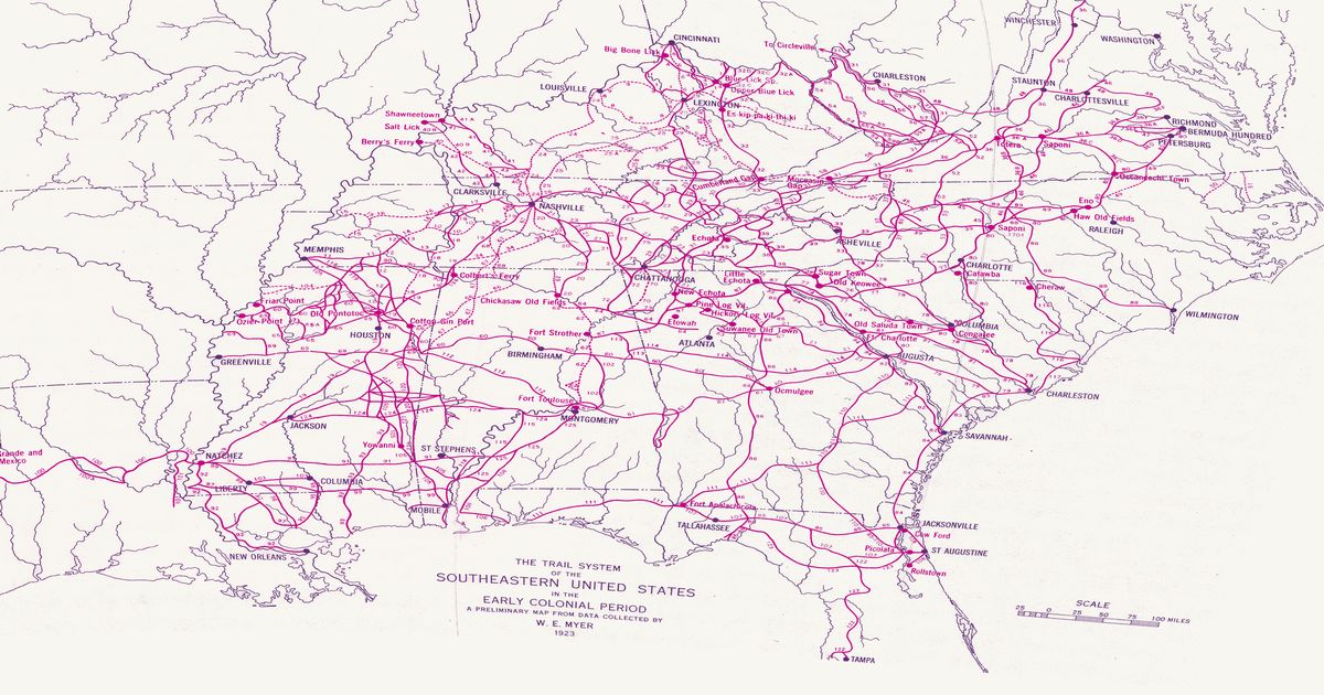
The Great Indian Warpath up the Valley of Virginia, the Occaneechi Path from the falls of the James to the Carolina interior, and the towns of the Saponi, Totero and Occaneechi, from Myer's 1928 BAE map.

Open full-screen map

Advertisement

Historic maps for Virginia

Preview of Smith’s Virginia, 1612 (1624 state)

Smith’s Virginia, 1612 (1624 state)

John Smith and William Hole, 1624 · about 26 km accuracy

John Smith’s map of the Chesapeake, engraved by William Hole and first published at Oxford in 1612; this is the 1624 state, issued with Smith’s Generall Historie of Virginia. Drawn from Smith’s voyages of 1607–08 and from what Native people told him, it names some 150 towns — the “Kings howses” of the werowances marked apart from the “Ordinary howses” — and the nations over their countries: the Powhatan paramount chiefdom on the James, the York, the Piankatank, the Rappahannock and the south shore of the Potomac; the Patawomeck, the Piscataway (Moyaons) and the Anacostan (Nacotchtanck) towns of the upper Potomac and the Patuxent towns; the Accomack, Accohannock, Wicomico, Kuskarawaok (Nanticoke), Ozinies and Tockwogh towns of the Eastern Shore; the Siouan-speaking Monacan above the falls of the James and Manahoac (Mannahoacks) above those of the Rappahannock; and the Susquehannock (Sasquesahanoughs) up the river at the head of the Bay. Small crosses mark how far Smith went himself: beyond them, as the key says, “what beyond is by relation” — drawn from what Native informants told him. North is to the right. Not shown: the engraved pictures (Powhatan in state, a Susquehannock man), the royal and Smith arms, the title, scale and cartouche, and the country drawn wholly from report — the Massawomeck lake, the Potomac above Smith’s farthest, and the Atlantic side of the Eastern Shore with the Atquanachuke towns.

Source: Library of Congress · Rights: public domain

Open in the map

Preview of Gallatin's tribes of North America, 1836

Gallatin's tribes of North America, 1836

Hon. Albert Gallatin; published by the American Antiquarian Society, Pendleton's Lithography, 1836 · about 100 km accuracy

Albert Gallatin's founding map of American ethnology, published by the American Antiquarian Society with his Synopsis of the Indian Tribes: the homelands of the continent's nations tinted by language family — Algonkin-Lenape, Iroquois, Cherokee, Muskogee, Choctaw-Chickasaw, Sioux, Blackfeet, Pawnee, Athapasca, Eskimaux — as of about 1600 along the Atlantic and about 1800 westward. A continental baseline: every state shows its nations here.

Source: Library of Congress, Geography and Map Division · Rights: public domain

Open in the map

Preview of Moseley’s North Carolina, c. 1733

Moseley’s North Carolina, c. 1733

Edward Moseley, 1733 · about 38 km accuracy

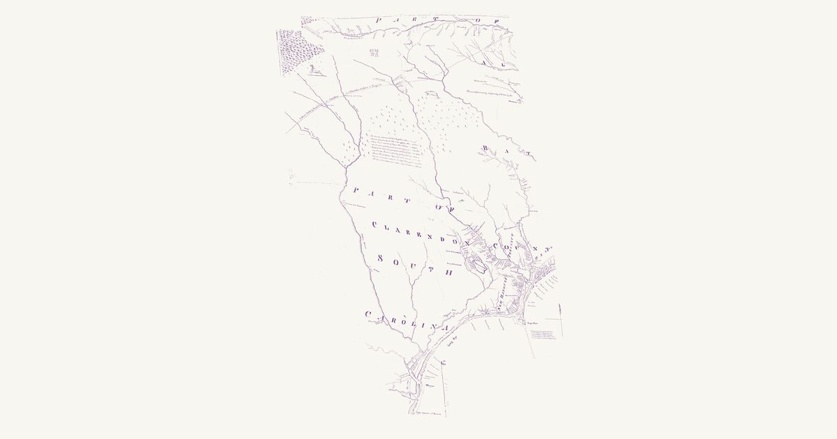
Edward Moseley’s manuscript map of the province, dedicated to Governor Gabriel Johnston and copied in 1822 for the U.S. Army’s Topographical Office. This is the western of its two sheets: from the Dan and the Roanoke at the Virginia line south across the Piedmont to the Cape Fear and the coast of South Carolina as far as Winyah Bay. Across the Piedmont runs the double-lined “Indian Trading Road from the Catawbos and Charokee Indians to Virginia”, past Keeauwee old Town and Acconeechy on the Eno and on north-east to the Roanoke — the path that linked Virginia with the Catawba and Cherokee, through the Saponi, Tutelo, Keyauwee and Occaneechi country of the Piedmont. The Saura (“Saraus”) and Keyauwee towns and the Pee Dee town are marked on the Pee Dee, and the Cape Fear settlements are drawn plantation by plantation. Moseley runs the Deep River into the Pee Dee, and draws the country west of the Yadkin as a range of mountains. The eastern sheet (the sounds, Edenton, Bath and New Bern) is a separate scan and is not included; nor are the dedication, the two harbour insets and the margins.

Source: Wikimedia Commons · Rights: public domain

Open in the map

Preview of Southeastern trail system, 1928

Southeastern trail system, 1928

William Edward Myer, 1928 · about 10 km accuracy

William E. Myer's preliminary map of the trail network of the colonial-era Southeast, compiled for the Bureau of American Ethnology from early maps, land records and field work: over 125 numbered trails, historic towns and sites from the Ohio River to the Gulf and from the Mississippi to the Atlantic. Georeferenced to thirty modern city locations.

Source: 42nd Annual Report of the Bureau of American Ethnology (Smithsonian Institution, GPO); scan via Yale Beinecke Library / Wikimedia Commons · Rights: public domain

Open in the map

Preview of Cumberland & Franklin, 1853

Cumberland & Franklin, 1853

J. G. M. Ramsey (engraved by W. Keenan), 1853 · about 16 km accuracy

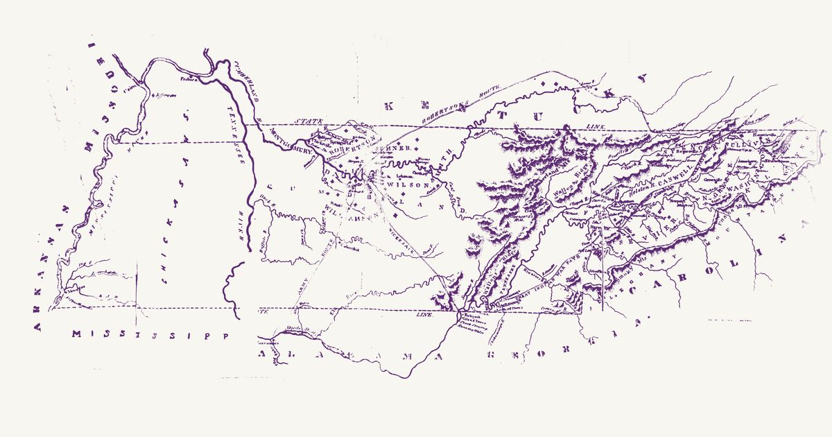
J. G. M. Ramsey’s map of the Cumberland settlements and the State of Franklin, engraved by W. Keenan of Charleston for The Annals of Tennessee to the End of the Eighteenth Century (1853): Tennessee from the Mississippi to the Unaka and Smoky mountains, with the edges of Kentucky, Virginia, North Carolina, Georgia and Alabama, as it was in the 1780s and 1790s — the counties of the Cumberland district and of the short-lived State of Franklin, the towns and stations, and the routes of the time. Ramsey letters the “Great Indian War Path” — the Great Indian Warpath, the north–south route through the Valley used by the Cherokee, Shawnee, Haudenosaunee and others — from Chickamauga past the Hiwassee and the mouth of the Tellico to Maryville, and over the French Broad and the Holston to the Long Island of the Holston. He marks the Chickamauga Cherokee towns on the Tennessee below Lookout Mountain (Chickamauga, Crow Town, Nickajack, the Island Towns and Running Water) and letters “Chickasaws” across West Tennessee. Robertson’s route to the Cumberland, the route of the 1794 expedition to Nickajack and an “Army Route” south to the Tennessee at Tuscumbia are drawn too. The title, and a dark printing flaw over the Tennessee River at the Mississippi line, are not shown.

Source: Internet Archive · Rights: public domain

Open in the map

Preview of Middle British Colonies, 1755

Middle British Colonies, 1755

Lewis Evans, 1755 · about 61 km accuracy

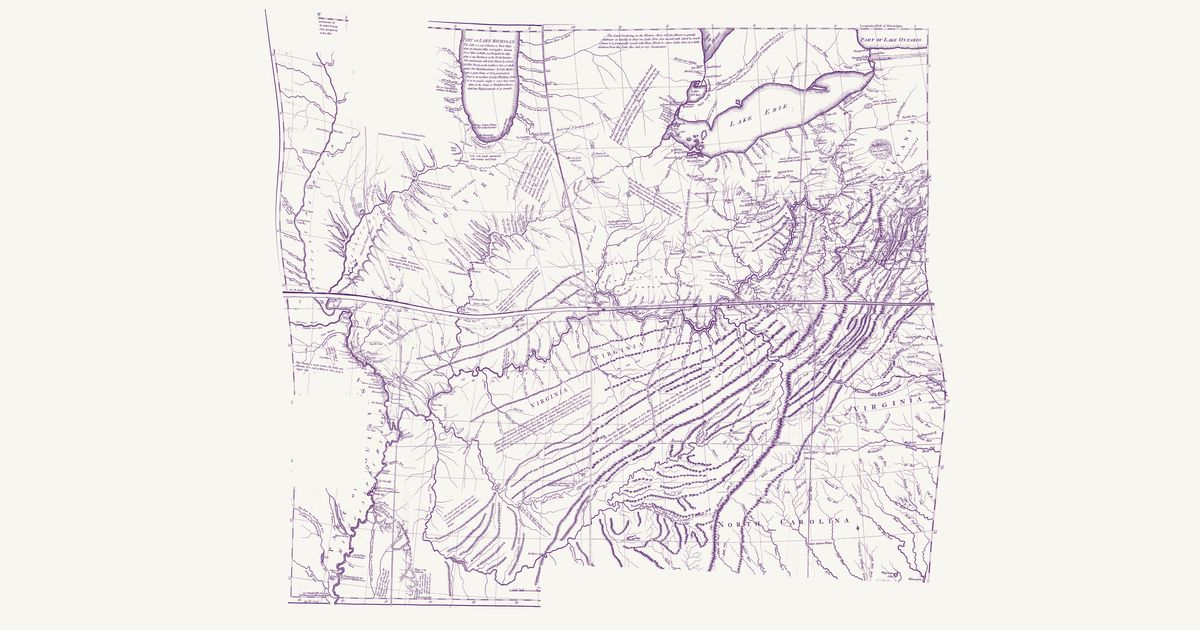
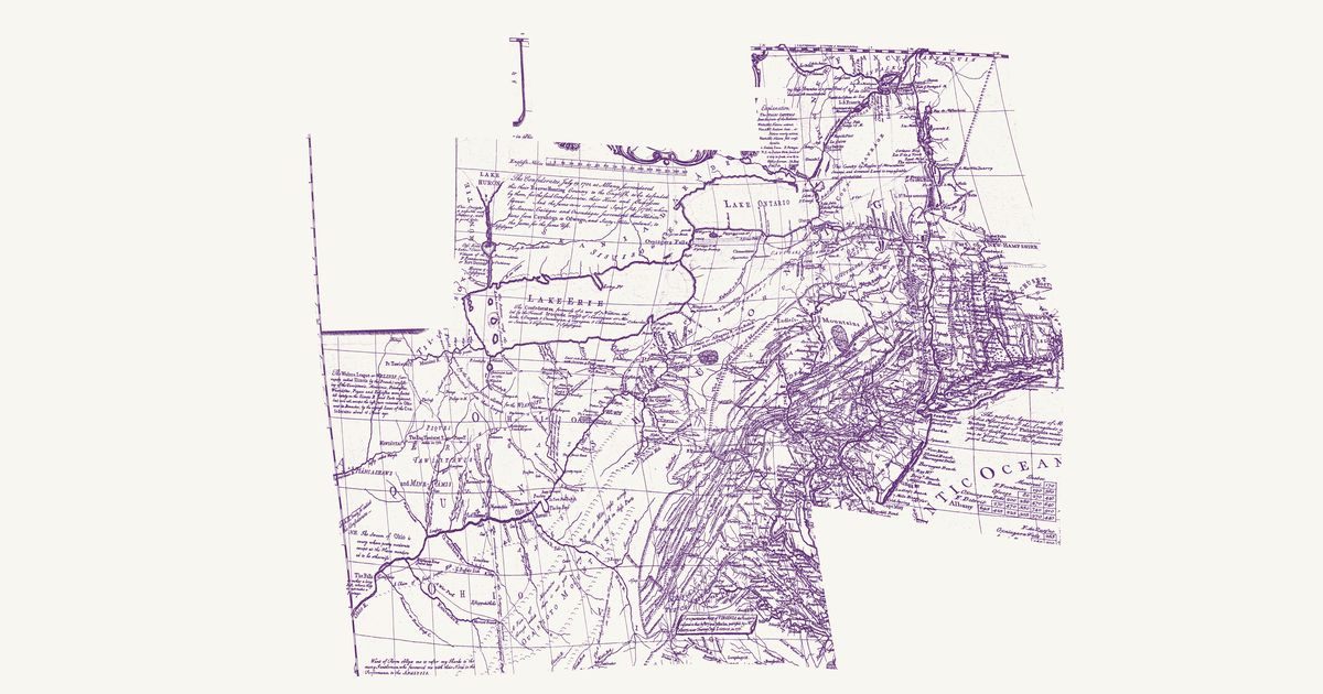
Lewis Evans’s 1755 map of the middle colonies and the Six Nations’ country: the Indian towns of the Ohio and the Susquehanna, the war paths and trading paths with their mileages, the portages, and his notes on the land, from Lake Ontario to the Kentucky country.

Source: Library of Congress · Rights: public domain
Open in the map

Preview of The Ohio country, 1778

The Ohio country, 1778

Thomas Hutchins, 1778 · about 52 km accuracy

Thomas Hutchins’s map of the Ohio country: the Indian paths and towns between Fort Pitt, Lake Erie and the Scioto, the War Path through the Cumberland Gap to the Cuttawa (Kentucky) country, and the Illinois villages, with his notes on the land.

Source: Library of Congress · Rights: public domain
Open in the map

Preview of Cherokee cessions, 1884 (Royce)

Cherokee cessions, 1884 (Royce)

Charles C. Royce (Bureau of Ethnology), 1884 · about 12 km accuracy

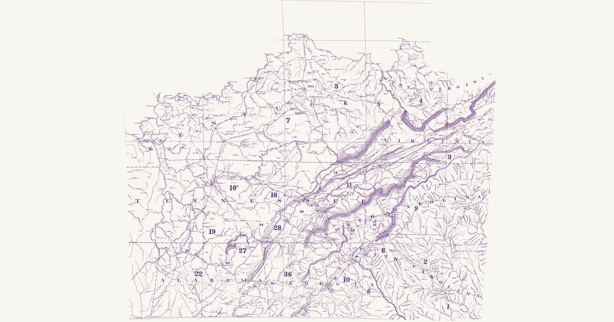
Charles C. Royce’s map of the former territorial limits of the Cherokee Nation, plate VIII of the Bureau of Ethnology’s Fifth Annual Report (dated 1884, published 1887): the country from the Ohio River to central Alabama and Georgia and from the lower Tennessee to the Carolina piedmont, on a base of the towns, rivers and graticule of the 1880s, coloured and numbered to show each tract the Cherokee (Aniyvwiya) ceded to the colonies and to the United States, from the treaty of 1721 with South Carolina to the treaty of New Echota in 1835. Over it Royce letters the old Cherokee and Creek towns and villages, the forts and stations of the frontier, and several old routes: the Great Indian War Path down the valley of East Tennessee, the Old Indian Path between Coosa and Tugeloo across north Georgia, the Old Creek Path west from Rome, the High Tower Path, the Old Cherokee Path to Virginia, the Old Cherokee Trading Path by Ninety Six to the Congarees, the Cherokee Traders’ Path to Yorkville, the Old Path from Tugaloo to Fort Charlotte and the Old Trading Path to the Catawba and Cherokee Nations from Virginia. The title and the numbered table of treaties are not shown. The site’s cessions layer is drawn from Royce’s cession areas; this overlay is the map itself.

Source: Library of Congress · Rights: public domain
Open in the map

Preview of Virginia and Maryland, 1755

Virginia and Maryland, 1755

Joshua Fry and Peter Jefferson, 1755 · about 28 km accuracy

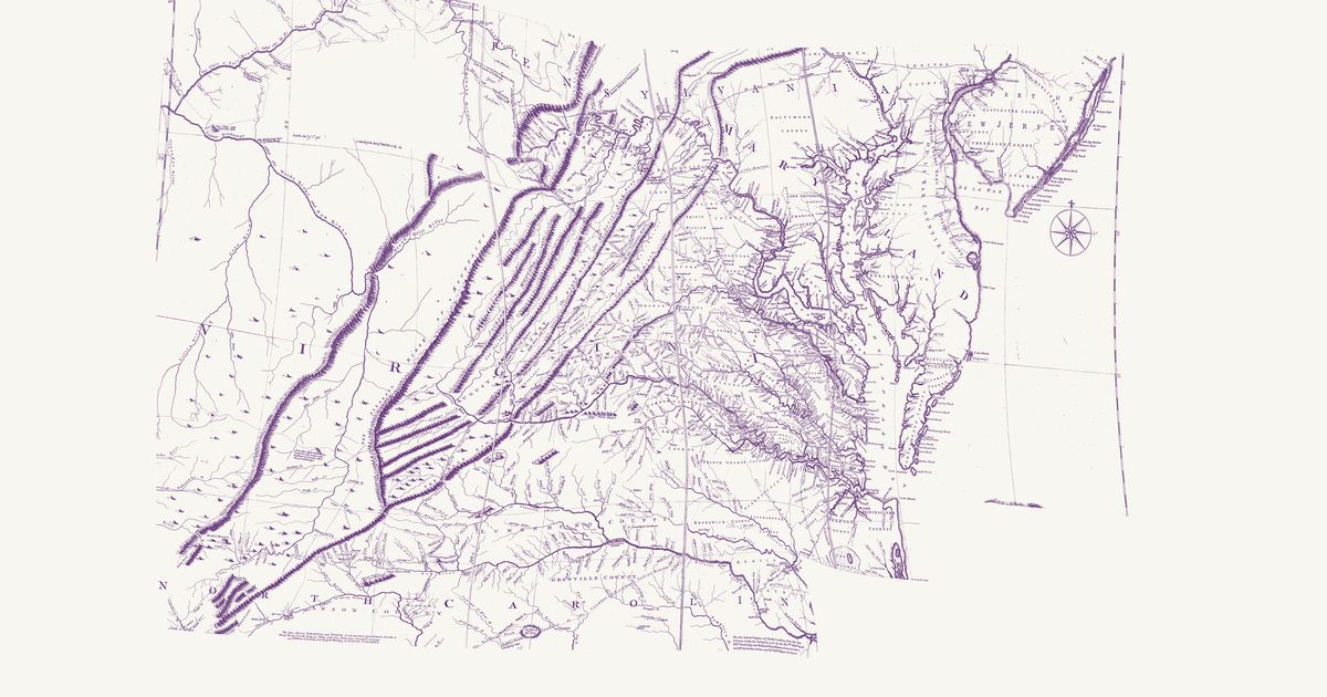
Joshua Fry and Peter Jefferson’s map of Virginia, in the 1755 Jefferys edition: the Indian Road by the Treaty of Lancaster down the Great Valley, the Indian road over the Alleghenies to the forks of the Ohio, and the Shawnee and Delaware towns of the upper Ohio.

Source: Library of Congress · Rights: public domain
Open in the map

Preview of New River Indian trail, 1901

New River Indian trail, 1901

Neander M. Woods, with John P. Hale, 1901 · about 3 km accuracy

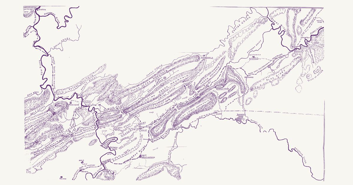
Neander M. Woods’s map of the country around Draper’s Meadows (Blacksburg) between the New and Roanoke rivers, drawn in 1901 with the help of John P. Hale of Charleston for The Woods-McAfee Memorial (1905), at four miles to the inch, from Hinton at the mouth of the Greenbrier to Roanoke, Buchanan and the Peaks of Otter — the site’s first map centred on the New River country of West Virginia. It shows “Various Ancient Trails & Roads of the Colonial Period of Virginia” and the homes of the Woods and McAfee families before 1775. Its key marks with a chain of arrows “The ancient Indian trail down New River from the Draper’s Meadows settlement”, which the McAfee company took in May 1773 on their way to explore Kentucky: from Blacksburg north to Sinking Creek at Newport, down Sinking Creek to the New River by Snidow’s Ferry, past Pearisburg and the Narrows, and down the river (“McAfee Route to Ky. May 1773”), crossing it at the mouth of Indian Creek, to the Bluestone, where it turns north and leaves the sheet short of Hinton. Long before the settlers, the New and Kanawha valley was a way through Shawnee, Cherokee and Siouan (Tutelo and Moneton) country; the map draws the trail in retrospect, 128 years after that journey. It also draws the old road from Philadelphia to the New River settlements, the Wilderness Road to Kentucky, the road to North Carolina, the routes of Gist, Walker and Boone, the Great Divide and the ridges as rows of hills. Not shown: the title, the key and the margins.

Source: Internet Archive · Rights: public domain

Open in the map

What the 1928 map shows

William E. Myer compiled the Bureau of American Ethnology’s trail map of the colonial-era Southeast from early maps, land grants and field work — over 125 numbered trails. The Great Indian Warpath up the Valley of Virginia, the Occaneechi Path from the falls of the James to the Carolina interior, and the towns of the Saponi, Totero and Occaneechi, from Myer’s 1928 BAE map.

Reading the overlay

At the plate’s small scale a drawn trail is a corridor several kilometres wide: read it as which valley and which gap, not which ridge. Switch to the scan layer to read Myer’s own lettering and trail numbers.

Talk about Virginia

Discussion board for VA

Start a thread All discussions

Know Virginia? Join free to add field notes, fix where a place sits on the map, and help find more maps.Join free

Sources from readers

Know a county history, a survey record or an article that bears on this? Add a source — it’s credited to you.

Advertisement