Wisconsin: Native trails and villages

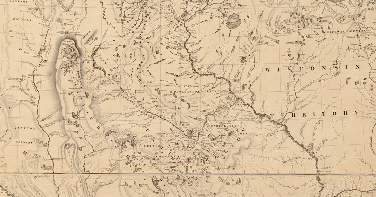
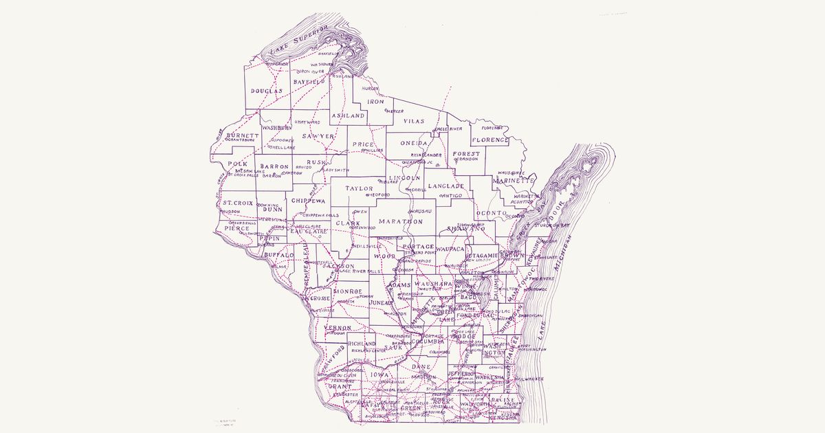
The Ojibwe country of the lake region on Nicollet's 1843 map; Brown's 1930 statewide trails map is next on the roadmap.

Open full-screen map

Advertisement

Historic maps for Wisconsin

Preview of Source of the Mississippi, 1832

Source of the Mississippi, 1832

Lt. James Allen, U.S. Infantry, 1832 · about 40 km accuracy

Lieutenant James Allen’s manuscript map of the 1832 expedition that Henry R. Schoolcraft led from Lake Superior to the source of the Mississippi, drawn for the War Department: the route up the St. Louis River and over the Savanna portage to Sandy Lake, up the Mississippi past Pokegama Falls, Lake Winnibigoshish and Cass Lake to Lac Traverse (Lake Bemidji), up its east branch and over the portage to Lake Itasca — “Lac La Biche, Source of the Mississippi” — then by Leech Lake and down the Crow Wing and the Mississippi past the Falls of St. Anthony to Fort Snelling, and up the St. Croix and down the Bois Brule to Lake Superior, with each day’s encampment, portage and rapid noted. It marks Ojibwe (Chippewa) villages at Fond du Lac, Leech Lake, the mouth of the Bois Brule, the Upper St. Croix lake, the Yellow and Kettle rivers and Rice and Muddy lakes in Wisconsin, Dakota (Sioux) villages at Big Stone Lake and below Fort Snelling, and the Sioux–Chippewa line of the 1825 treaty of Prairie du Chien. Three Native routes are drawn and named — an “Indian Route” through a chain of small lakes, with a portage between each, from the expedition’s camp east of Itasca to Leech Lake; an “Indian Route from Leech” south-east through Boy Lake, Turtle Lake and Lac du Canard; and an “Indian Trail” from Muddy Lake to Ottawa Lake (Lac Courte Oreilles) in Wisconsin — Ojibwe routes through their lake country. The Red River valley, which the expedition did not see, is sketched from report; Red Lake, drawn too freely to place, is not shown, nor are the title, north arrow and scale, two labels marking mounds, and the paper lost along the folds.

Source: Wikimedia Commons · Rights: public domain

Open in the map

Preview of Gallatin's tribes of North America, 1836

Gallatin's tribes of North America, 1836

Hon. Albert Gallatin; published by the American Antiquarian Society, Pendleton's Lithography, 1836 · about 100 km accuracy

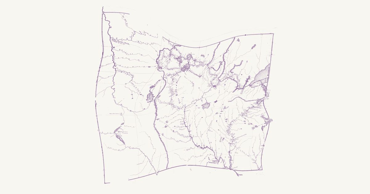
Albert Gallatin's founding map of American ethnology, published by the American Antiquarian Society with his Synopsis of the Indian Tribes: the homelands of the continent's nations tinted by language family — Algonkin-Lenape, Iroquois, Cherokee, Muskogee, Choctaw-Chickasaw, Sioux, Blackfeet, Pawnee, Athapasca, Eskimaux — as of about 1600 along the Atlantic and about 1800 westward. A continental baseline: every state shows its nations here.

Source: Library of Congress, Geography and Map Division · Rights: public domain

Open in the map

Preview of Nicollet's Upper Mississippi, 1843

Nicollet's Upper Mississippi, 1843

J. N. Nicollet, assisted by J. C. Frémont; U.S. War Department, Bureau of the Corps of Topographical Engineers, 1843 · about 25 km accuracy

Joseph Nicollet and John C. Frémont's War Department map of the upper Mississippi country — the most accurate map of its era, made with Dakota and Ojibwe guides. It names each nation's country — Mdewakanton, Wahpekute, Sisseton, Yankton, Yanktonai, Teton, Ojibwe, Ho-Chunk, Sac and Fox, Omaha, Otoe, Ioway, Ponca, Pawnee — with villages and hundreds of Dakota and Ojibwe place names: Mini Wakan, Kichi Gummi, Minsi Sagaigoning.

Source: Library of Congress, Geography and Map Division · Rights: public domain

Open in the map

Preview of The Ohio country, 1778

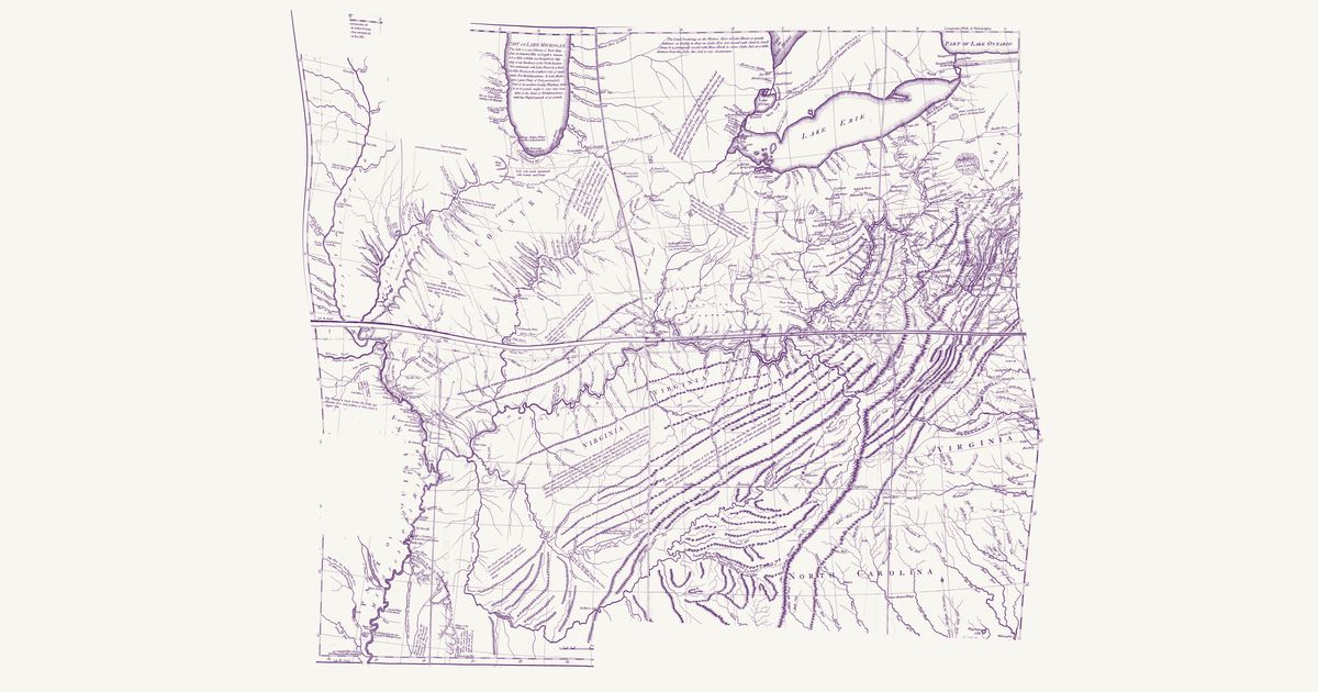
The Ohio country, 1778

Thomas Hutchins, 1778 · about 52 km accuracy

Thomas Hutchins’s map of the Ohio country: the Indian paths and towns between Fort Pitt, Lake Erie and the Scioto, the War Path through the Cumberland Gap to the Cuttawa (Kentucky) country, and the Illinois villages, with his notes on the land.

Source: Library of Congress · Rights: public domain

Open in the map

Preview of Wisconsin Indian trails, 1930

Wisconsin Indian trails, 1930

Charles E. Brown, 1930 · about 9 km accuracy

Charles E. Brown’s statewide map of Wisconsin’s Indian trails for the Wisconsin Archeological Society: the trails in red across every county, from Lake Superior and the St. Croix to the Fox–Wisconsin portage, Lake Winnebago and the Lake Michigan shore, drawn from the Society’s trail surveys.

Source: Wisconsin Historical Society · Rights: public domain

Open in the map

Preview of Eastern Wisconsin trails, c. 1830

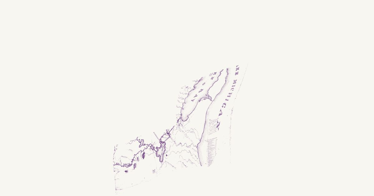
Eastern Wisconsin trails, c. 1830

U.S. War Department, 1830 · about 21 km accuracy

A War Department manuscript map of eastern Wisconsin from about 1830, drawn for the lands ceded by the Menominee, Ho-Chunk and the New York Indians in 1821: the dotted routes from Green Bay up the Fox past the Menominee village and the Chutes to Lake Winnebago, around its eastern shore toward Chicago, by Lake Michigan to the Manitowoc, and on to the Butte des Morts, Yellow Thunder’s village and Green Lake, with Indian villages and a table of distances from Green Bay.

Source: Wisconsin Historical Society · Rights: public domain

Open in the map

Preview of Southern Wisconsin trails, c. 1829

Southern Wisconsin trails, c. 1829

U.S. War Department, 1829 · about 19 km accuracy

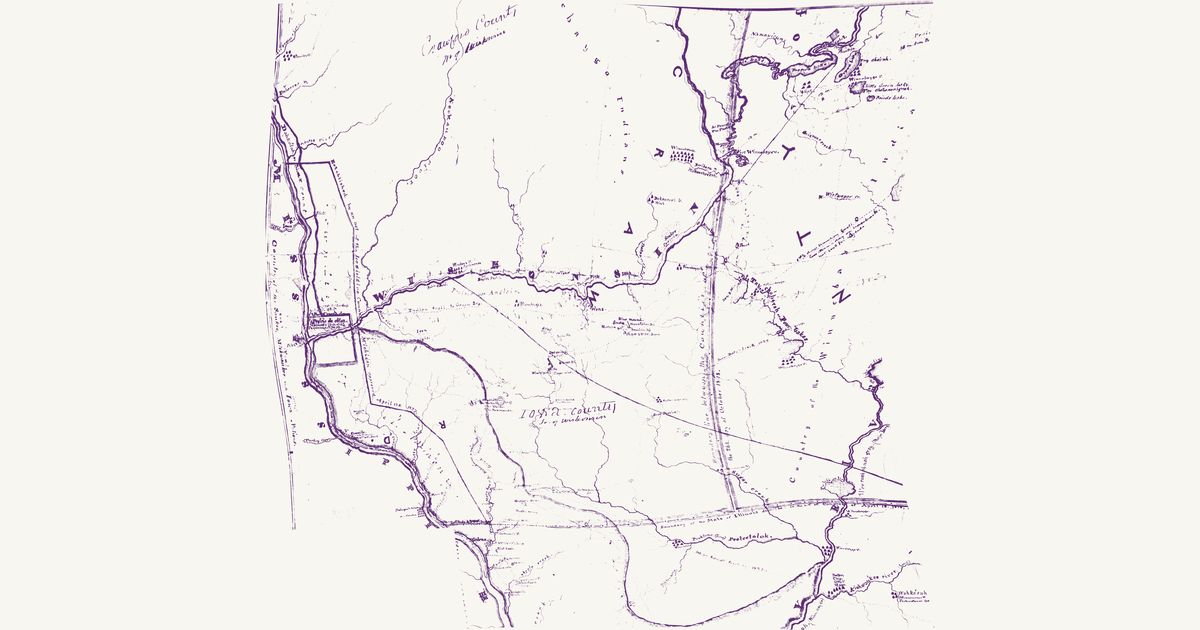
A War Department manuscript map of the lead-mine country from about 1829, known from a 1933 photostat: the Wisconsin from the Portage to Prairie du Chien, with the “Indian trail to Green Bay” lettered along its south bank and running on past Helena and the Blue Mound to the Four Lakes; the Mississippi from the Prairie la Crosse down past Dubuque’s mines and Galena; and the Rock, the Pecatonica and the Kishwaukee in northern Illinois. It marks the Ho-Chunk (Hocąk) villages of the time — at the Four Lakes, Green Lake and the Baraboo, on the Wisconsin (Waukon’s and Karamanee’s), on the Pecatonica and along the Rock — and the lodges of Potawatomi, Ojibwe, Odawa and Menominee at the Kishwaukee, names the country of the Sauk, Meskwaki and Ioway and of the Dakota west of the Mississippi, and adds the lead diggings and new towns (Galena, Mineral Point, Dodgeville), Lyons’s latitudes, the county lines, Judge Doty’s track of 1829 and Major Long’s of 1823, and the texts of the 1804, 1816 and 1825 treaties. The lower Rock River and the Mississippi below Rush creek, drawn too freely to place, are not shown.

Source: Wisconsin Historical Society · Rights: public domain

Open in the map

What the 1843 map shows

Joseph Nicollet mapped the upper Mississippi country in 1836–40 with Dakota and Ojibwe guides, and his War Department map records each nation’s country and hundreds of Dakota and Ojibwe place names — the most accurate map of the region for decades.

Reading the overlay

The southern sheet lands within about ten kilometres; the northern lake country nearer twenty-five. Switch to the scan layer to read the engraved names.

Talk about Wisconsin

Discussion board for WI

Start a thread All discussions

Know Wisconsin? Join free to add field notes, fix where a place sits on the map, and help find more maps.Join free

Sources from readers

Know a county history, a survey record or an article that bears on this? Add a source — it’s credited to you.

Advertisement